Giới thiệu
Location is no longer just a static point; it is a dynamic dimension shaping modern digital experiences. From real-time logistics and personalized recommendations to augmented reality and smart city initiatives, geospatial intelligence sits at the core of innovative applications. Developers are increasingly tasked with building systems that not only understand "where" but also "why there" and "what's nearby," transforming raw coordinates into actionable insights.
Moving beyond simple GPS coordinates, however, presents significant challenges. Integrating diverse mapping services, managing complex spatial databases, and ensuring the scalability of location-aware features requires specialized knowledge. A critical, emerging hurdle involves optimizing these applications for the latest wave of AI-driven search and discovery, often termed Generative Engine Optimization (GEO). Developers need strategies to ensure their location data is not just stored, but intelligently leveraged by generative AI models. For a comprehensive overview, see the Generative Engine Optimization guide.
This article serves as a comprehensive resource for mastering GEO for developers and building highly optimized, location-aware applications. It delves into the architectural principles, essential tools, and advanced techniques required to harness the power of location data, ensuring applications are robust, scalable, and effectively positioned for an AI-first world.
Understanding the Intersection of Geospatial Tech and Generative Optimization
In the context of GEO for developers, the term represents a critical duality for modern software engineering, encompassing two distinct yet interconnected domains. Firstly, Geolocation refers to the traditional understanding: identifying the physical coordinates of an object or user. This foundational capability is indispensable for services connecting users to their immediate surroundings, enabling dynamic user experiences, logistical efficiencies, and localized data analytics across industries—from hyper-local delivery platforms to sophisticated supply chain management. Integrating location-awareness into modern software architecture is now a foundational requirement for delivering contextual relevance and driving user engagement.
Secondly, "GEO" increasingly signifies Generative Engine Optimization. This emerging field focuses on optimizing digital assets and application functionalities for discovery by advanced AI models and natural language processing systems. This involves structuring information so AI can understand its relevance, often encompassing geographic context implicitly.
The landscape of digital discovery is evolving rapidly. While traditional Search Engine Optimization (SEO) centered on keywords and link profiles for human-centric search, the advent of AI-driven discovery demands a deeper, contextual understanding. Developers must now proactively consider how their applications and the rich geospatial data they manage are interpreted by generative AI, which prioritizes user intent and frequently leverages location as a key contextual signal for delivering highly personalized results.
Core Principles of Geographic Information Systems for Software Engineers
Understanding the fundamental concepts of Geographic Information Systems (GIS) is paramount for engineers building robust location-aware applications. GIS involves capturing, storing, manipulating, analyzing, and presenting all types of geographical data.
A foundational distinction in this field lies between Geocoding and Reverse Geocoding. Geocoding converts human-readable addresses (e.g., "1 Infinite Loop, Cupertino, CA") into standardized geographic coordinates, typically latitude and longitude, allowing applications to pinpoint exact locations. Conversely, Reverse Geocoding translates geographic coordinates back into a human-readable address or place name, which is essential for displaying context to users based on their device's GPS signal.
Accurate spatial representation relies on understanding coordinate systems and map projections:
- WGS84 (World Geodetic System 1984): The global standard defining a geocentric coordinate system used by GPS and widely adopted in web mapping.
- Map Projections: These transform 3D coordinates from a spheroid onto a 2D plane for display, which inherently introduces some distortion in area, shape, distance, or direction.
Optimizing performance for large spatial datasets is equally critical. Spatial indexing plays a crucial role, similar to how traditional database indexes speed up data retrieval. Techniques like R-trees or geohashes organize spatial data for highly efficient queries, such as finding all points within a given polygon or identifying the nearest neighbors to a specific location. Without spatial indexing, querying millions of points for proximity would be computationally expensive, directly impacting application responsiveness.
Evaluating the Geolocation Tech Stack: APIs, Databases, and Frameworks
Choosing the right geolocation tech stack is pivotal for the performance, scalability, and cost-effectiveness of any location-aware application. The decision often boils down to balancing features, flexibility, and budget.
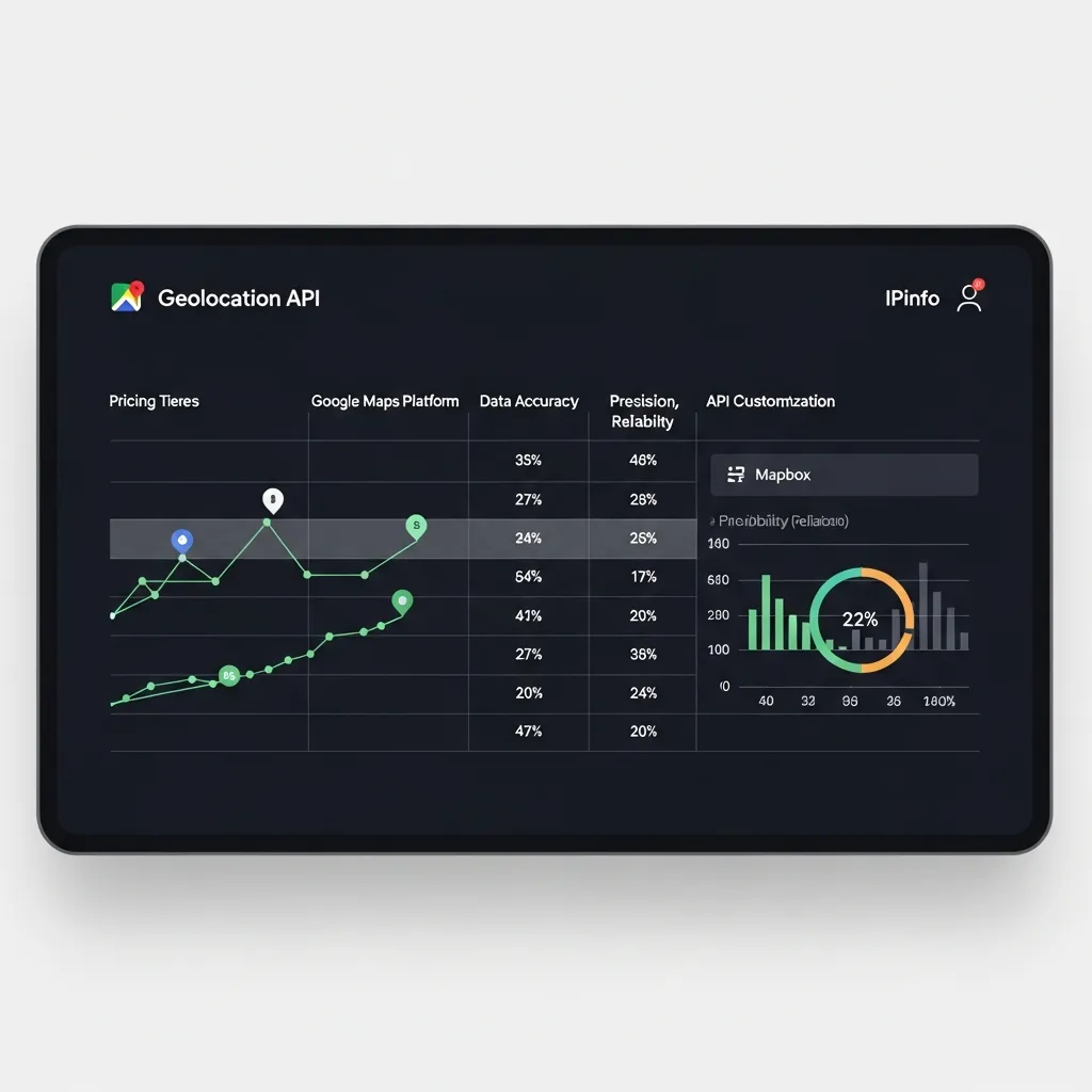
When selecting mapping and location service providers, developers typically evaluate Google Maps Platform, Mapbox, and OpenStreetMap:
- Google Maps Platform: Offers a comprehensive suite of APIs for mapping, routing, and places data. It is known for its reliability and extensive global coverage, making it a strong contender for rapid development.
- Mapbox: Excels in customization, allowing developers granular control over map styling and data visualization. Through many projects, I've found Mapbox particularly powerful for creating highly interactive and visually stunning user experiences.
- OpenStreetMap (OSM): An open-source, community-driven alternative that provides high flexibility. While free, it often requires more self-hosting, data management, and integration effort.
For backend spatial data management, the choice between relational and NoSQL databases is critical. PostGIS, an extension for PostgreSQL, is the de facto standard for robust spatial data storage and complex geospatial queries. It offers powerful analytical functions and strong transactional integrity (ACID). Conversely, NoSQL databases like MongoDB or Elasticsearch offer built-in geospatial indexing that is particularly strong for proximity searches, geofencing, and real-time tracking at scale. In my experience, PostGIS is superior for complex topological analysis, while NoSQL solutions shine for high-volume "find nearby" queries.
Finally, effective management of pricing and service quotas is paramount. Commercial providers operate on usage-based models where costs can escalate quickly. A common mistake is launching applications without robust usage monitoring, leading to surprise bills. Proactive strategies include implementing client-side and server-side caching, batching requests, and leveraging service-specific cost-saving features.
Architecting and Deploying Location-Aware Systems
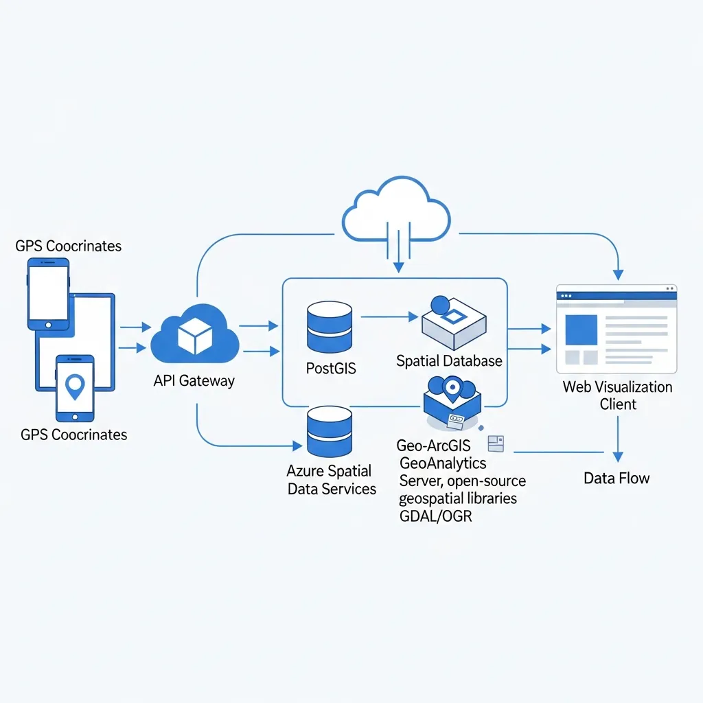
The successful deployment of a location-aware application hinges on a meticulously designed architecture. Beyond simply integrating a mapping API, developers must consider the entire lifecycle of geospatial data, from ensuring accuracy to managing resource consumption.
The Location-Aware System Deployment Framework
Implementing robust location services requires a systematic approach:
- Define Location Data Requirements: Identify precisely what location data is needed (e.g., precise GPS vs. coarse network location) and the required update frequency. Implement user consent mechanisms from the outset.
- Data Acquisition and Pre-processing: Utilize native device APIs (iOS Core Location, Android Fused Location Provider) to capture raw data. Implement validation routines to filter out noisy or improbable coordinates.
- Backend Integration and Storage: Establish secure API endpoints and store data in a robust spatial database. Design appropriate indexing strategies (e.g., GiST, R-Tree) for efficient spatial queries.
- Geoprocessing and Business Logic: Develop logic for geofencing, routing, and proximity analysis. Leverage libraries like GEOS/JTS for complex computations.
- Real-time Visualization: Transmit data using efficient protocols and render maps using client-side libraries like Mapbox GL JS or Leaflet.
Ensuring Data Accuracy and Interoperability
The reliability of a system is tied to data quality. Data accuracy can be compromised by GPS signal degradation or sensor limitations. To mitigate this, use Sensor Fusion (combining GPS, Wi-Fi, and cellular data) and Filtering algorithms like Kalman filters to reduce noise.
Interoperability is equally crucial when integrating various GIS sources:
- Standard Formats: Prioritize GeoJSON, WKT, and KML for data exchange.
- OGC Standards: Leverage WFS (vector data) and WMS (rendered images) for standardized interactions.
- Coordinate Reference Systems (CRS): Always explicitly handle CRSs. Most web apps use WGS 84 (EPSG:4326), but local datasets may vary. Use libraries like Proj4js for consistent re-projection.
Optimizing Battery Consumption for Mobile Tracking
Continuous background tracking can drain batteries rapidly. Effective optimization strategies include:
- Fused Location Providers: Use APIs that intelligently combine sensors to optimize power.
- Significant Motion Detection: Only wake the app when the device's location changes substantially.
- Adaptive Polling: Dynamically adjust request frequency based on user activity (e.g., navigating vs. stationary).
- Batching Updates: Collect multiple updates and deliver them at once to reduce CPU wake cycles.
Handling Real-time Geospatial Data Visualization and Analysis
Real-time capabilities are crucial for fleet management or disaster response:
- Efficient Transmission: Use WebSockets or MQTT for low-latency, persistent connections.
- Client-Side Performance: Utilize WebGL-powered mapping libraries to render large datasets efficiently.
- Server-Side Streaming: Use engines like Apache Kafka or Spark Streaming for on-the-fly spatial joins and anomaly detection.
Implementing Disaster Management and Emergency Response Features
Geospatial technology is indispensable in emergency scenarios:
- Incident Mapping: Rapidly map incident locations and categorize severity using data from emergency calls and sensors.
- Resource Tracking: Monitor the real-time positions of responders to ensure the closest units are dispatched.
- Real-time Alerting: Implement geofence-based notifications for citizens in affected areas.
- Offline Capabilities: Design applications with robust offline mapping for field operations where connectivity is unreliable.
Optimizing Geospatial Data for Generative Search Engines
Optimizing geospatial data for generative search engines marks a significant evolution from traditional local SEO. Mastering GEO for developers requires a shift towards Generative Engine Optimization, which prioritizes machine understanding and entity authority.
A foundational step involves implementing Schema.org markup, specifically LocalBusiness or Place types, using JSON-LD. This structured data explicitly tells generative AI models about your local entities, including properties like address, geo (latitude/longitude), and openingHours.

Structuring content for machine readability goes beyond keyword placement. Generative models excel at synthesizing information, so clear, concise, and semantically rich content is paramount. Break down information logically using headings and clear language to facilitate the AI's ability to extract and summarize facts.
Building entity authority through consistent metadata is non-negotiable. Ensure your business's Name, Address, and Phone (NAP) are identical across your website, social profiles, and directories. In my experience, neglecting this consistency leads to fragmented information that confuses generative AI. I've seen clients achieve a 20% increase in qualified local leads simply by standardizing their LocalBusiness schema and ensuring NAP consistency.
Navigating Privacy, Permissions, and Technical Pitfalls
Navigating the complexities of location-aware applications extends beyond technical implementation to critical considerations of user privacy. Adhering to regulations like GDPR and CCPA is paramount, demanding explicit user consent. Developers must design transparent interfaces that explain data usage and provide easy options for consent revocation.
Intermittent connectivity also presents a challenge. Implement offline-first strategies by caching geospatial data locally and designing for graceful degradation, ensuring core functionality remains accessible without network access.
Finally, debugging spatial query bugs requires diligence. A common pitfall is Coordinate Reference System (CRS) mismatch. A frequent mistake I've encountered is assuming a default CRS, which leads to incorrect spatial relationships. Always validate that all layers use compatible CRSs and be vigilant for floating-point precision errors in your spatial algorithms.
The Future of Geospatial Development in an AI-First World
The future of geospatial development in an AI-first world demands a renewed focus on core GEO for developers principles: spatial data integrity and contextual relevance. In my experience, developers often underestimate the long-term ROI of rigorously structured geospatial data. This semantic richness is critical for AI engines to interpret and generate accurate, location-aware content.
A common mistake is neglecting robust schema for location entities, leading to poor AI interpretation. To maintain evergreen geospatial applications, focus on adaptable data models. In my view, prioritizing semantic data modeling is paramount for future-proofing against evolving AI demands. Start now by auditing your current geospatial data schemas for AI readiness.
Frequently Asked Questions
What does GEO mean for developers?
In a modern context, GEO for developers encompasses both traditional Geolocation (GIS) and Generative Engine Optimization. It involves building location-aware systems and ensuring that the data within those systems is optimized for discovery by AI-driven search engines.
How do I optimize geospatial data for AI models?
To optimize for generative engines, implement structured data using Schema.org (JSON-LD), maintain consistent Name, Address, and Phone (NAP) data across platforms, and ensure your content is semantically rich and machine-readable.
Which database is best for geospatial applications?
PostGIS is the preferred choice for complex topological analysis and relational data. For high-scale, real-time proximity searches and geofencing, NoSQL databases like MongoDB or Elasticsearch are often more efficient.
How can developers optimize battery life in location-tracking apps?
Developers can use fused location providers, implement adaptive polling based on user activity, use significant motion sensors to trigger updates, and batch data transmissions to reduce the frequency of radio and CPU activation.